Simplifying
Land
Management
Connecting councils, contractors, and landowners in an efficient and secure way to maximise the investment and effort put into managing environmental tasks and outcomes.
Weeds in Australia
According to DCCEEW the cost of weeds to agricultural industries is estimated at $4 billion per year. There are approximately 3000 different weed species in Australia.
Around $180 million is spent at a federal and local level annually to combat invasive weeds.
Every council seems to have a different way of engaging with spraying contractors and landowners, often leading to an opaque process that lacks efficiency, coordination, oversight, and governance.
Contractors often lack the tools to effectively plan and coordinate spraying jobs, and regularly rely on multiple different systems for planning, scheduling, timesheets, collecting and store compliance data.
Welcome to OpenRoad
An all-in-one solution for managing the fight against noxious weeds in Australia.
Whether you are a council, land-manager, or contractor, OpenRoad empowers you manage environmental tasks more effeciently.
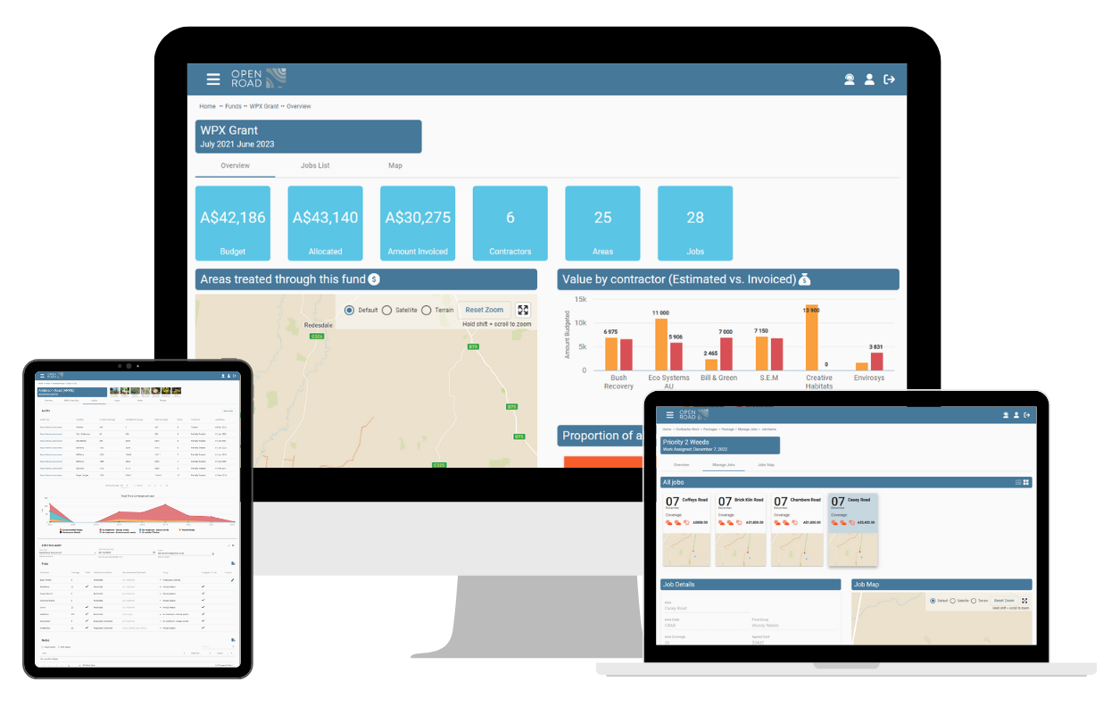
OpenRoad allows you to create assessment records (digital twins) of geograhical assets and record data points (locations, quantities, photographs) about weeds, pests, and land management activities. Those records can be turned in jobs and assigned to contractors or internal teams, along with weather, scheduling and compliance data.
Key Features
OpenRoad is your one-stop-shop for simplifying land management. Here are just a few of the key features you can expect.
How does it work?
Assess and Schedule
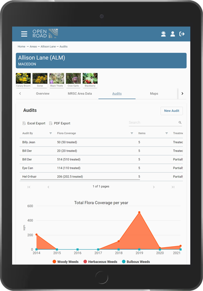
Inspect Assets
- View previous assessments
- Create a new assessment
- Inspect vegetation
- Estimate weed and pest quantities
- Record activities and tasks
- Take photos
Analysis
- Identify areas needing treatment
- Group areas by location proximity, sensitivity, conservation value, and priority
Schedule
- Create packages of work
- Assign work to contractors
- Coordinate contractor work with other activities
Schedule and Treat
Schedule
- View scheduled work
- Manage schedule of work
- View weather data
- Assign work crews
- View alerts
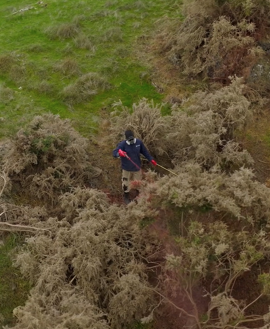
Perform Work
- Communicate updates
- Record complianace data
- Communicate updates
- Connect with adjoining landowners
Complete
- View status of jobs
- Record compliance data
- Update job status
- Invoice work
Report
Oversight
- View schedule of work
- Manage budgets & costs
- Verify jobs via photos and GPS time records
- View compliance data (chemial use etc.)
Interact
- Communicate in real-time about jobs and projects
- Add and share notes and photos
Visualise
- The spread of weeds
- View treatment effectiveness
- Visualise species and change over time

Angularis (the developer of OpenRoad) was established in 2022 to make a difference in the world through the provision of innovative technology focused on the agricultural and environmental sectors.